Within minutes of one of the Fraser Canyon’s easiest little hikes at the old Alexandra Bridge, the level of difficulty ramps up quickly on the newly-enhanced Tikwalus Trail, which starts 100 meters north of the Alexandra Lodge.
Formerly known as the “First Brigade Trail,” the Tikwalus (teek’-wa-LOOSH) route was so brutal that 70 of the 400 pack horses perished — and one of the 50 workers committed suicide, rather than make the return trip to Fort Kamloops.
Fair warning, then: this is not a walk in the park — but if you’re in reasonable shape and have a good dose of mental fortitude, the Tikwalus Trail can give you a great sampling of the difficulties experienced by early Europeans, and the First Nations people who developed the route thousands of years ago. During the five to six-hour hike, you’ll see dramatic views of the canyon, amble through stands of ancient cedar and Douglas fir and learn about the history of the trail through the many interpretive signs erected along the path.
You get an easy head start, too. You don’t have swim your horses across the Fraser River first. You probably have a warm bed to return to, as well. Just park your vehicle and head up the mountain.
This is a thirst-inducing trek, so pack plenty of water or carry a water treatment device. Also consider leaving extra litres of water in your vehicle, for recovery after the hike.
I wish I had.
The first few minutes on the trail will hopefully have you wondering “what’s so difficult about this?” You’ll soon see. The first section was necessary to connect the parking area to the original trail, says Kelly Pearce, of the Hope Mountain Centre for Outdoor Learning.
A key feature on the new section is the bridge with the curved logs forming part of the railing. Pearce says a danger tree had to come down and its shape inspired builder Dan Pereda to slice it down the middle and incorporate the pieces into the bridge. Justin Brown and Darwin Baerg worked with Pereda, under contract for Hope Mountain Centre, which supplied some volunteer workers.
In 2010, a provincial grant of $98,000 was granted to the partnership of Spuzzum First Nation, Hope Mountain Centre and New Pathways to Gold Society and a month of trail enhancement took place in August and September of 2011. The official reopening was on April 20 this year.
Once on the original path, elevation starts to build at a rapid pace. The first two kilometres see a 430 metre lift and it doesn’t let up much after that until you’re past the three kilometre mark.
Officially, it’s a 788 metre gain — from trailhead to high point — but if you consider the dips and doodles, it’s probably a higher overall gain than the world’s tallest building, the 829.84 metre Burj Khalifa tower in Dubai.
Google that thing. It’s huge! And that is your hike on the Tikwalus... up and down in six hours, with no elevator.
Bring water.
There’s more to the hike than hard work, though. Just past one kilometre, there’s a vantage point and the first of eight interpretive signs that tell the rich history along the route.
Appreciate the extensive research — and the effort in getting the signage to the lofty locations.
“They were all packed in by manual labour,” says Pearce. No helicopters were used, even for the food cache at the campsite. “The outhouse came in the 1990s,” adds Pearce, “but was repositioned when the campsite was built.”
A few minutes after the two kilometre marker, you’ll cross a little bridge over a stream. This is your only easy chance at water, so have a splash and tank up... if you’ve brought some way of treating the water. No one needs “beaver fever.” There are lakes and swamps further up, but you have to work to get to most of them — and this water is clean and cold.
This must have been a favourite stop for the two brigades that ventured along this trail and I can imagine the horses and men clamouring for a drink.
Water was only one of the horses’ problems, though. Pearce says that there was little for them to forage on in the forest, other than pine needles and cedar boughs. Meanwhile, they were laden down with packs of fur, such as beaver, marten, otter and weasel from the northern regions.
“These horses were unshod,” adds Pearce. “I’m not a horse man, but I’m told that this would have been very hard on the horses’ hooves. If they came up lame, they’d be killed — and eaten. Nothing would be wasted.
“Overland from the Nicola Valley would have taken several days, at least,” figures Pearce. “The horses would have been starving by then.”
For horses of the outgoing brigades, a swim across the Fraser River was soon in-store. The first brigade was in May of 1848, so the water would have been in freshet.
It only took the Hudson Bay Company one more attempt to realise a better route was needed. Meanwhile, the trail stayed in use by local natives — and by the early gold rush prospectors, before the completion of the Cariboo Waggon Road in the early 1860s.
Continuing on the trail, near the three kilometre mark, there’s a great downriver vista at the Chief Pahallak viewpoint.
About one hour into the trek, you’ll be into lush forests of cedar and fir. Watch for signs of culturally modified cedar, where bark was harvested by native people.
If you’ve been grinding your way along, you’ll reach the junction in about 1.5 hours. My friend, John Koopman and I took the path to the left but we would recommend going right first, if you have time for the whole loop.
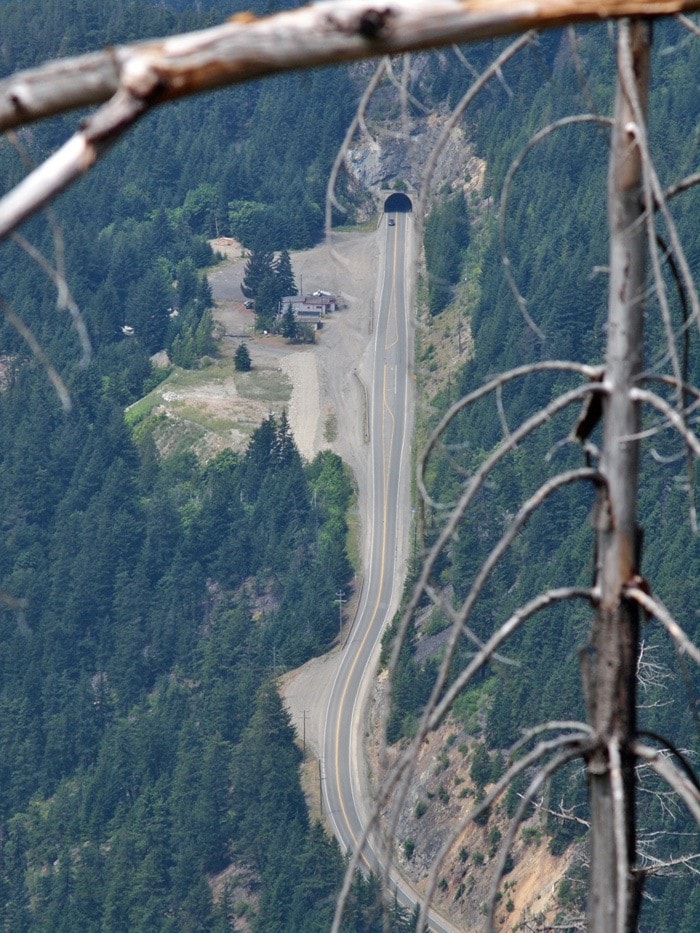
Going right (north-east), you continue into the forest, getting to a point where you are totally immersed in nature, as it must have been thousands of years ago. On many other parts of the trail, you can still make out the hiss of traffic from the highway or rumbling of trains on the rails. Not here. Enjoy it.
Continue on to the campsite, then take the bluffs route back to the junction. Thanks to an earlier forest fire, the view from the bluffs is wide open. You can look down on the Elvis Rocks the Canyon restaurant and dream of how good it would be to sit down and refuel.
There’s no easy way there, though. You’ve got a tough couple of hours of downhill ahead of you.
This concludes our four-part series on trails in the area, though we’ll be back to cover ongoing developments by the Hope Mountain Centre.
Until then: take a hike!