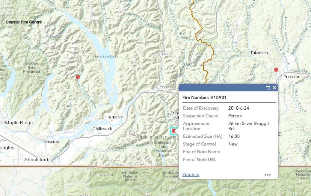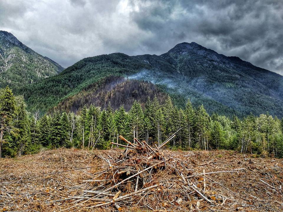
Wildfire crews are close to containing a 16 hectare (160,000 square metre) fire burning since Sunday, 20 kilometres south of Hope above Silver Skagit Road.
In an update on Facebook June 24, the BC Wildfire Service stated the fire was burning in a ‘very remote area’ around the 26 kilometre mark of Silver Skagit Road. The fire is being worked on by at least 26 firefighters with the help of a helicopter, but it is not posing a threat to human life or values, apart from timber.
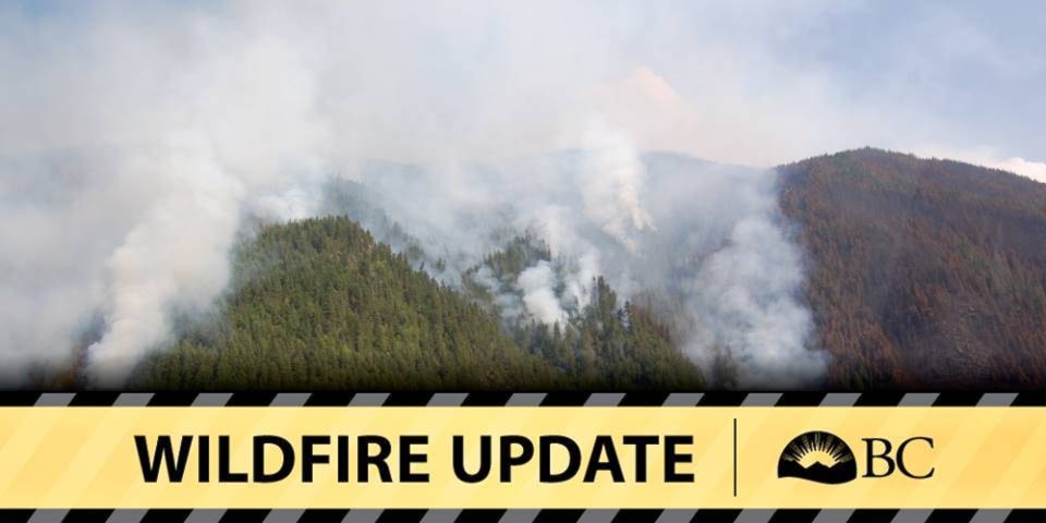
From being classed as a rank one, smouldering in the ground or a creeping surface fire, the fire is now classed as held said Dorthe Jakobsen, communications assistant at the wildfire service.
“It’s got a fair number of resources attending. We’ve got a full unit crew, which is 20 firefighters, we’ve got an incident commander and we’ve got two inital attack crews which are usually another six firefighters,” Jakobsen said Monday. The same amount of firefighters were still on the fire Wednesday.
“They are laying holes and working towards the inside of the fire, which means that they are expecting to have the fire under control by the end of today (Wednesday),” she said.
A map on the BC Wildfire Service website states the fire is suspected to be person caused. The cause of the fire is under investigation Jakobsen said, and until this is completed there is no way of knowing the cause.
“We’re moving into a cooler, moister period, which is good for wildfires,” she said. “(This fire) isn’t expanding and it is small, a rank one, so it certainly shouldn’t be sending alarm bells up for anyone.”
After the fire has been contained, the crews will monitor the fire for a few days. “It may smoke for a little while, but eventually the fuel will burn itself out,” Jakobsen said.
Is there more to this story?
news@hopestandard.com
Like us on Facebook and follow us on Twitter