The province says Highway 1 through the Fraser Canyon has reopened after an earlier closure due to the Kookipi Creek wildfire.
The highway, between Boston Bar and Lytton, reopened Tuesday (Aug. 29) after the Transportation and Infrastructure Ministry and its crews completed the removal of dangerous trees and loose rocks from the bluffs above the highway.
However, drivers could have lengthy delays along the route as it will be single-lane, alternating traffic through the Falls Creek (Jackass Mountain) highway reconstruction project. There could also be possible lane closures for fire-related repairs and maintenance.
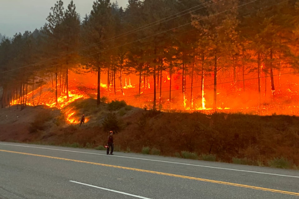
The highway was closed for more than a week when the wildfire crossed Highway 1 on Aug. 18.
The Kookipi Creek wildfire remains active in the Fraser Canyon, and the highway could close again depending on conditions.
“This includes the possibility of proactive closures during rainfall to ensure the safety of travellers as the fire-damaged hillside may shed runoff and debris,” reads the advisory from the province.
READ MORE: Kookipi Creek fire destroys Nahatlatch Fire Lookout tower
As of Tuesday (Aug. 29), it was and estimated 16,961.6 hectares.
The Kookipi Creek wildfire is part of the Canyon Complex, which is made up on seven wildfires in the Fraser Canyon.
Chris Werrell, the operations section chief with BC Wildfire Service, said Tuesday that his team his responding to the Kookipi, Izman Creek and the Stein Mountain wildfires. Izman Creek is estimated to be 115.7 hectares while the Stein Mountain is an estimated 3,421.6 hectares.
“We’ve had a difficult time seeing a lot of the fire, but we have seen upwards of rank 4, mostly seeing agressive burning conditions at night. When the smoke lifts we’re able to finally see some of that.”
BCWS division supervisor Brandi Burns said it’s been really challenging with these fires as there is a lot of steep terrain and crews have been challenged daily with winds.
Burns said crews have been able to be efficient in battling the fires with the closure of Highway 1, but with that reopening Tuesday “that’s going to be another complexity.”
The other four wildfires in the Canyon Complex include Ponderosa Creek, Texas Creek, Rutledge and Cottonwood Creek.
Ponderosa Creek, which was discovered July 14, is listed at 5,021.6 hectares as of Aug. 28. It’s about 20 kilometres northwest of Lytton in the Stein Mountain Nlaka’pamux Heritage Park.
Texas Creek, which was discovered July 9, is 101 hectares. It’s 27 kilometres south of Lillooet.
The Rutledge wildfire is 17 hectares and was discovered on July 14.
Cottonwood Creek is an estimated 854.9 hectares and was discovered on Aug. 11.
READ MORE: Lytton First Nation evacuation order expanded for Stein Mountain wildfire
@laurenpcollins1
lauren.collins@blackpress.ca
Like us on Facebook and follow us on Twitter.