Canoeists and kayakers looking for a safe and peaceful place to spend an afternoon should consider the Hope River, at the north end of Chilliwack.
From the Fraser River, up to the east end of Mount Shannon, there are some nine kilometres of navigable water — even more when the water is higher in springtime. Weeds and shallow spots make it unfriendly for motorized boats... thus perfect for paddlers. There’s not much elevation drop over the route, even less when the Fraser River is high and causing the Hope River to back up, so there’s not much current to deal with whichever direction you choose to go.
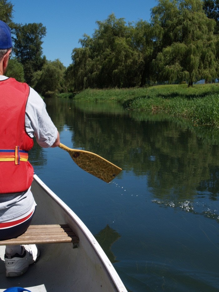
At its widest, this tributary might be five boat lengths across, so you’re never far from shore but you still need to follow normal boat safety practices and wear a personal floatation device.
There are three main access points where you can park your vehicle and launch your boat. The best of these is at the Lions’ Hall on Hope River Road, three to four kilometres east of Young Road.
Near the upper end of the route, you can park and launch at the corner of Hope River and Camp River Roads, though the parking is less abundant. If you intend to head down to the Fraser, another launch point is from the park at the north end of Corbould Street. Heading north on Young, it’s about one kilometre from Five Corners. Just before you cross the bridge near Minter’s Country Garden store, turn left on Berkeley Avenue and continue a few blocks until you get to Corbould.
On our trip, we headed down from Corbould first and got to the Fraser River in about 40 minutes. There’s plenty of time to turn around and avoid going into the current. Do that.
In 1856, Chilliwack Landing was a riverboat stop at the mouth of the Chilliwack River, just downstream of the mouth of the Hope River — before the Chilliwack River was diverted into the Vedder canal. Flooding and the lack of available land after the establishment of native reservations helped convince European settlers to take the townsite further inland. Chilliwack Landing is now gone but the name lives on at the Chilliwack Landing Leisure Centre.
The origin of the name Hope River has been a bit of a mystery to me, which was made a little clearer after a visit to the Chilliwack Archives. Their 1856 map showed all of the local water bodies — so someone had done a comprehensive exploration — but the map didn’t include a label for the Hope River.
Fort Hope was established in 1848 and welcomed its first fur brigade via Peers Creek in 1849. The Hudson Bay Company used flat-bottomed bateaux boats to bring the furs downriver to Fort Langley, then to carry trade goods back upstream to Fort Hope. There was no evidence either way — but I would think that the bateaux boatsmen would have considered an upstream trip through the Hope and Camp River sloughs, as the current is much easier than the Fraser’s. It also would have saved them about a kilometre, while bringing them back to the main river just downstream of where the Agassiz-Rosedale Bridge now sits.
Could the return trip to Hope have given the little river its name?
If not, perhaps it was from the New Westminster to Yale Waggon Road, completed in 1875. That road was constructed along an established footpath that followed the Hope River from Mount Shannon through what is now Rosedale and on to Popkum, eventually bringing travelers to Hope.
In any case, Hope Slough is clearly labeled on an 1876 map. There was no Hope family listed in the Chilliwack area until after the First World War, so the river’s relationship to the trip to Hope must have factored in the naming of the river.
Back to the present: when the water gets low, in August and September, the one kilometre Young Road to Menzies Road section is especially weedy along the surface. It’s plain ugly and you might want to avoid it. If you soldier through, it’s a little over an hour from Young Road to the top end of the route, at Meadowlands Golf Course.
Upstream from the Lions’ Hall, you pass under the Chartwell Drive bridge and you’ll soon be into what I call “The Green Mile,” a beautiful stretch of waving green swamp grass that brings you to the confluence of the Camp and Hope rivers. If you only have a bit of time, this is the part to paddle on.
In the 1940s and 1950s, Dayton’s Pool was a popular swimming hole, situated just upstream of the land bridge on Camp River Road. Now, only historic photos and memories remain. The Camp River is not easily navigable, due to human encroachment, so continue upstream on the Hope River for another kilometre, if you wish. As the water gets lower, fallen trees may restrict your passage.
If you’re confident in your boating skills — or have a waterproof camera — you might want to bring some photo gear along. You’re bound to come across wildlife such as beaver, muskrat, herons and bald eagles. Long lenses and high shutter speeds will give you the best results on wildlife shots but due to the instability of the boat, you’ll likely need to be in the 1/1000th speed range to avoid motion blur on long lenses. Go faster, if you can manage it.
Considering the wing motion of a heron launching from the weeds, you’ll be glad of a quick shutter. Speaking from experience, 1/350th just results in a blurred bird.
Bring along a picnic lunch and enjoy your day on the Hope River, a gentle, meandering waterway.